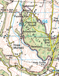
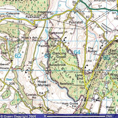
Ruardean is show on this map.The green area is the Royal Forest of Dean. To the left as you look at the map is Wales. After Ruardean the family lived at Bartwood, then Bailey Brook and Dancing Green. [Bartwood is often referred to as Barnwood]
They attended church at Hope Mansell. I've ben to all of these places and will post a photo of the cottage at Bailey Brook which still stands.
In order to view the entire area just click on this link then enter Ross On Wye. You can then view all of the forest, Wales, Ruardean, Little Dean, Twekesbury and other areas.
If you go south once you have the map up you can see Cheptow and the Castle used in King Arthur.
Arthur was the Prince of Wales and descended from the Silures who the first Britons.
They sailed from the Iberian Peninsula long before Rome invaded England. There were other tribes as well, all Celtic.
You can also go to Google Maps and put Westbury on Severn, Erngland. From there you can view Ruardean, Hope Mansell, Twekesbury and Wales.
Cheptow is also close to the South. Monmouth, where the legend of King Arthur was written is just a short distance. Some believe that the Forest was the Forest of Dean where various stone formations are found indicating the early Druid period.


